月島付近
Tsukishima Fūkin
(Moon Island Area)

First of all, happy holidays to you! I hope you’re all able to stay warm during this winter season.
My last article on the Edo Period fishing island of Tsukudajima, raised the unavoidable problem of what to do about all the landfill that extended the island substantially southwest along the coast of the bay. I could have broken up each neighborhood into small articles, but that would have taken a long time. Separately, they might not be as interesting to read. So I decided to combine all of them as an early クリトリスプレゼント Kuritorisu purezento Christmas present to you all. It’s also a present to myself so I can relax during the coming 御正月 O-shōgatsu New Year Holiday. This year I’ve burnt the candle at both ends and it’s finally caught up with me. I can’t wait to relax.
Today we have a lot of ground to cover so let’s get right into it, shall we? Today we’re going on a whirlwind tour from Tsukiji to Tsukuda to Tsukishima to Kachidoki to Toyomi-chō ending in Harumi looking towards the future.

築地
Tsukiji
(landfill, literally “fabricated land”)
| 築 | man-made, fabricated |
| 地 | land |
The word “tsukiji” means fabricated land. Modern Japanese uses a different word for landfill today, 埋立地 umetatechi which means something like “built up land.”
The name means landfill because, that’s exactly what it was. After the 明暦大火 Meireki Taika Meireki Conflagration[i] in 1657, the first landfill efforts were conducted in this area. The shōgunate began extending the area from 鉄砲洲 Teppōzu Rifle Sandbar[ii] southward. At the time, Teppōzu was where the mainland was closest to 佃嶋 Tsukudajima Tsukuda Island. The new expansion was simply called 築地 Tsukiji “fabricated land.”

Anyways, the gray areas are commoner towns, the large white areas are daimyo, the small white areas are samurai residences.
That’s Tsukuda Island to the right. The tiny red areas in Teppozu are land owned by the Teppozu Shrine.
An interesting side note about the name Teppōzu. It survives only in the name of a shrine. In 1624, 鉄砲洲稲荷神社 Teppōzu Inari Jinja Teppōzu Inari Shrine was built in the area. The shrine is famous for a wacky winter festival which culminates in 寒中水浴 kanchū suiyoku ritual purification by taking a group bath in freezing water (that link is video of this year’s event, btw). The shrine was moved to 八丁堀 Hatchōbori in 1868.

Anyways, after the fire in 1657, the 浅草御坊 Asakusa Gobō (a residence for priests of 浅草本願寺 Asakusa Hongan-ji Asakusa Hongan Temple) was rebuilt on part of the reclaimed land. Later, a temple and cemetery were built next to gobō that served the needs of the inhabitants of the area. A local town and economy sprung around the temple, called a 門前町 monzen-chō in Japanese[iii], and the area began to flourish. Eventually some 武家屋敷 buke yashiki samurai residences and 大名屋敷 daimyō yashiki daimyō residences were built in the area as well.
The temple that was built here was named 築地本願寺 Tsukiji Hongan-ji Tsukiji Hongan Temple (a branch temple of the and because of its unique architecture is a local landmark. It was a traditional Japanese temple until it was destroyed in the 関東大震災 Kantō Daishinsai Great Kantō Earthquake of 1923. The present concrete structure is a weird mix of Western Neo-Classicism, Southeast Asian Buddhism, and fascist architecture that looks like a basilica/cathedral mated with a temple and shat out a concrete baby. That said, it’s a unique building and it’s pretty hard to miss.

Tsukiji Hongan-ji was built by 伊東忠太 Itō Chūta and was completed in 1934. I don’t know much about Chūta who designed this monstrosity, but he seems to have been the darling of the Japanese Empire. His designs, in my humble opinion, are just clownish. He took the soul out of traditional architecture in an attempt to westernize it. But that’s just my opinion and I can’t deny that his influence was huge. In the Post WWII era, you’ll find many buildings built by his students and architects influenced by him, including so-called traditional buildings. But just to give you an idea of some of his other work: he designed the 遊就館Yūshūkan the biased, pro-imperial museum at 靖国神社 Yasukuni Jinja Yasukuni Shrine. The building boasts a style that would look great on the dead Kim Jong-il or Joseph Stalin.
Oh, and he designed this:

Kyoto!!I rest my case.
I’m sorry. My bitching is almost finished. I have one more thing to complain about this temple. You see, it has another claim to fame. The funerary ceremony[iv] of “rock[v]” musician, Hide[vi], was held at Tsukiji Hongan-ji[vii]. Many people with bad taste in music consider him the Curt Cobain of Japan. After he killed himself in 1998, his bad fashion sense and inability to do rock, metal, or industrial music properly launched an entire fashion and music movement in Japan[viii]. The movement came to be called ヴィジュアル系 vijuaru-kei visual style – usually called V系 V-kei today. As far as the bands go, they’re ridiculous looking post-gal style clown shows.

I mean, if you want people to take you seriously…
Clowns.
Back to the History – Foreigner Zones
Sorry, got off track there but I had to get off my chest while researching this.
So, way back in 1869 (Meiji 2), foreigners still weren’t a common site in Japan and given the animosity towards and even violence against foreigners since the 1850’s that had been commonplace[ix], the major ports of Japan often had special “foreigner towns” set up where non-Japanese could live peacefully without having to deal with any BS from the locals[x]. And so in 1869 (Meiji 2), a 居留地 kyoryūchi foreign settlement[xi] was established in Teppōzu. The area had foreign schools, churches, and buildings associated with the newly born international spirit of trade. The American School in Japan was established in the foreign settlement in 1902 (Meiji 35).

Also, I don’t want to paint the Japanese as being completely racist here. These settlements were born out of a necessity of the Bakumatsu. Radical samurai were indeed trying to assassinate any foreigners they deemed as a threat – they were straight up terrorists. The Japanese had a highly complex hierarchy that was unfamiliar to the newly come foreign embassies. The foreign nations had negotiated for exemption from things like kowtowing to daimyō processions and beheadings and such because… well, they couldn’t wrap their heads around it[xii]. The shōgunate assigned samurai bodyguards to protect the foreigners and established “foreigner zones” to keep them safe. In the new “Meiji Chill Out™[xiii]” foreign settlements, many established before the coup, were areas where commerce and official business could be conducted in a kind of creole and mash up of styles that was conducive to everyone. The Christian westerners could get their Jesus on in peace and educate their kids in their parents’ languages. They didn’t have to learn Japanese to survive. A foreigner could sit in a chair and not the floor. A Japanese person could wear foreign fashion and not take any shit for it. Fair enough [xiv].

With the establishment of an imperial navy, the area became an education center for naval officers. Beginning in 1888 (Meiji 21), present day 築地 Tsukiji was the home to the 海軍経理学校 Kaigun Keiri Gakkō the Naval Administration School of the Japanese Empire. The school operated on that property until the end of WWII. The founder of the Japanese Navy and one of the real visionaries of the late Edo Period, 勝海舟 Katsu Kaishū, even served as a professor in the area[xv].

No boat style.
Awwwwww yeah!
The area began a kind of transformation after the 関東大震災 Kantō Daishinsai Great Kantō Earfquake in 1923. Most of the old Edo Period buildings were burnt to the ground, but the area didn’t modernize overnight. Of course, the Naval Academy was rebuilt as soon as possible. But Edo’s fish market, which had also been burnt to the ground, needed to be rebuilt. The Nihonbashi market was no longer as convenient as it had once been, so it was decided to relocate the fish market to Tsukiji. The construction of a “modern” market facility opened in 1935. The modern Tsukiji Market has been a work in progress ever since. There is a great debate about moving it now, much to the dismay of the locals. So far the market remains in its place and if you want some ridiculously delicious 江戸前寿司 Edomae-zushi Edo-style sushi, then get your ass there.

佃
Tsukuda
(cultivated field)

So, the other day I wrote about this location. Directly across from Teppōzu was a fishing island called 佃島 Tsukudajima Tsukuda Island. Located on this island, was the official fishing concession of the Tokugawa Shōgunate. The original article is long and really is the background for this article. I highly suggest you read it.
The island was expanded southwards by landfill. Whether the shōgunate or whoever was in charge of the building project knew or cared where the name “Tsukudajima” came from isn’t really important. By this time, a folk etymology had come about where people thought that Tuskudajima’s “tsuku” was related to 築地 Tsukiji’s 築 tsuki build, fabricate and the daily word 作る tsukuru make, build. So the new landfill’s name was bound to be affected by this collision of roots. Which brings us to our nest place name…

月島
Tsukishima
(moon island)

| 月 | moon |
| 島 | island |
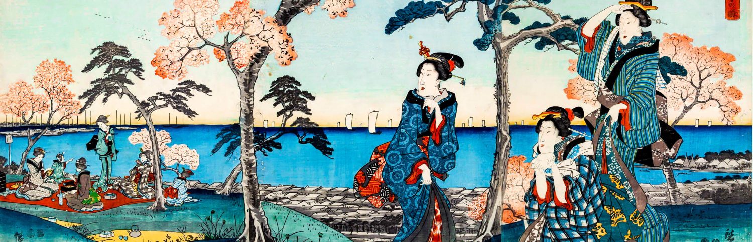
In the Edo Period, there were no televisions or movies or love hotels with jacuzzis and 25 channels of porn. One possible option for date night was heading down to 月之岬[xvi] Tsuki no Misaki Cape Moon to watch the moon rise over the bay. Restaurants, tea houses, and other types of businesses lined the bay in 三田 Mita that offered rooms with a view of the bay for this very purpose[xvii]. 月見 tsukimi moon viewing is a famous past time of “Old Japan” and so I don’t feel much need to go into it any deeper. Even to us, the moon is a pretty spectacular thing to behold. Unfortunately, the coastline of Edo Bay was immediately built up by the new Imperial Government after the Meiji Coup. As a result, the area called Tsuki no Misaki was built over and faded into oblivion.

If I’m not mistaken, this is one from the outskirts of Edo in Shinagawa.
But this is what a party room would look like on Edo Bay.
A new landfill build up was begun in 1887 (Meiji 20) and completed in 1892 (Meiji 25). This extended Tsukuda Island southwards significantly. As I’ve shown, 築地 Tsukiji was a place name that existed on the mainland from the Edo Period. 佃 Tsukuda was also a place name. And there was ample reason to mix up the “tsuki” of Tsukiji and the “tsuku” of Tsukuda and the “tsuki” Tsuki no Misaki.
In 1892, the 東京市参事会 Tōkyō-shi Sanjikai Tōkyō City Council gave the new landfill the name 月島 Tuskishima “Moon Island” and although we don’t have the exact reason written down, it seems fair to say the name is a mash up of 月の岬 Tsuki no Misaki (Moon Cape) and 佃島 Tsukudajima (Tuskuda Island) and Tsukishima (Landfill Island→Moon Island), obviously opting for the kanji 月tsuki moon over the kanji 築 tsuki landfill for esthetic reasons.
For most of its history, Tsukishima has been decidedly 下町 shitamachi low city. But in the last 15-20 years the area has seen an influx of タワーマンション tawā manshon sky rise apartments. Some long time and some short term residents of Tsukishima and Tsukiji have been fighting hard to prevent over development of the area. Tsukishima is famous as the もんじゃの街 monja no machi monja town. Monja-yaki is a local Tōkyō delicacy… that was once described to me as “something that looks like barf on an iron grill, but taste really yummy.” That was not encouraging to hear, but since monja-yaki and okonomi-yaki are usually considered a kind of Wonder Twins of Japanese shitamachi cuisine, I have to say that to my palate, monja is way more flavorful. In Tsukishima, you can go to the もんじゃストリート monja storīto monja street and find monja-yaki of every type, from the most simple Shōwa style to the most cutting edge styles. If you ever come to Tōkyō, a visit to Tsukishima and a little dabbling in the world of monja-yaki is a must. I’ve heard there are about 70 monja shops in the area.

If we move a little farther south on the new land fill, things become a little complicated. We start seeing names like 晴海 Harumi and 勝ちどき Kachidoki.
勝鬨
Kachdoki
(a victory cry)

| 勝 | win, victory |
| 鬨 | war cry |
As soon as they had time to think about city planning, the Meiji Government had plans to connect present day 築地 Tsukiji with 佃島 Tsukudajima (Tsukuda), home of the area’s most powerful fishing concession in Edo Bay[xviii]. But government money was tight and fishermen have boats, so fuck it. The fishermen could just take a boat over and deliver fish the way they had for hundreds of years. Tuskuda’s location was ridiculously good and the rivers of Edo-Tōkyō were sufficient.
However, in 1905 (Meiji 38), a ferry crossing was established that connected Tsukiji with Tsukishima. Boats would taxi people and goods from the mainland to Tsukuda/Tsukishima. Who was using this particular crossing? Well, presumably the 海軍経理学校 Kaigun Keiri Gakkō Naval Administration School in Tsukiji and what were they doing at Tsukishima… let’s just say they were getting fresh seafood.

However, after the 日露戦争 Nichiro Sensō Russo-Japanese War (1904-1905), the Naval Administration School set up an 碑 ishibumi memorial to commemorate the 旅順陥落 Ryojun Kanraku Fall of Port Arthur. The name was the 勝鬨ノ碑 Kachidoki no Ishibumi Victory Cry Monument. The location was the landing of the ferry crossing and as such the ferry crossing was called the 勝鬨渡し Kachidoki Watashi Kachidoki Crossing.
In 1915, the sail boats or oar-driven boats came to be replaced by steamships, which could carry much more cargo to and from Tsukiji and Tsukuda/Tsukishima. Tōkyō’s population was exploding and as such the traffic from Ishikawajima, Tsukuda, Harumi, etc., was so heavy both ways, a bridge was built.
In 1933 (Shōwa 8), Tōkyō finally got around to building that bridge they’d been putting off for so long. Construction was finished in 1940 (Shōwa 15)[xix]. This being the peak of Japanese nationalism, I’m sad to say, that the “Victory Cry Monument” seemed as good a namesake as any for the bridge. And voilà! We have a 勝鬨橋 Kachidoki-bashi Kachidoki Bridge. The bridge was built as a draw bridge to accommodate large military steam ships passage. To the best of my knowledge, the bridge doesn’t open these days.

Do it!! You know you want to!
Incidentally, today the name isn’t written 勝鬨 kachidoki, but 勝どき kachidoki. The reason is that after WWII, major reforms in Japanese spelling were made and the kanji 鬨 toki was removed from the list of 当用漢字 tōyō kanji general use kanji so there was no choice but to write it in hiragana.
Let’s move down to the next section of landfill, shall we?

豊海
Toyomi
(abundant sea)

Toyomi is the southernmost and smallest section of the original manmade island. It lay directly across from the former 浜御殿 Hama Goten Seaside Palace, a villa of the Tokugawa[xx]. The view from this villa would have been a magnificent view of Edo Bay – possibly good for viewing a moon or two. The park is absolutely beautiful, but the view of the bay is blocked by landfill and skyscrapers.
That said, in 1963 a new landfill expansion was completed and the name was decided by the residents via questionnaire. The name is a mix of the following kanji:
| 豊 | abundant, rich, bountiful, excellent |
| 海 | sea, ocean, waters |
| 町 | town |
The meaning of 豊海町 Toyomi-chō is essentially “bountiful sea town” and looks quite charming on paper.
The first kanji is particularly auspicious. For one thing, the character appears in the name of 豊臣秀吉 Toyotomi Hideyoshi, the second of Japan’s so-called 3 Great Unifiers. It also appears in the Tōkyō place name 豊島 Toshima, which I wrote about in 2013. The area owes a lot to the bountiful waters of Tōkyō Bay. For all of its history it’s been a wharf for fishing boats and a home to a whole gaggle of refrigerated seafood warehouses.

晴海
Harumi
(clear seas)

The last area we’re going to look at is a second landfill island built to the east of the other places we talked about.
First, let’s look at the kanji.
|
晴 | clear |
|
海 | sea, ocean |
晴海 Harumi is a perpendicular, man-made island that lies directly east of Tsukishima, Kachidoki, and Toyomi. Building out the land fill began from Tsukuda in the middle of the Meiji Period and was finally completed in 1929.
In 1939, the residents of the island voted to divide the area into six 丁目 six chōme blocks and named it 晴海町 Harumi-chō Harumi Town. The idea being that they lived on the bay and they always hoped for 晴れ海 hare umi tranquil waters. Recently built landfill was merged with the older area and the number of chōme was reduced to 5. The suffix 町 chō town was also eliminated. The future of Harumi should be interesting. The 選手村 Senshu Mura Olympic Village for the 2020 Tōkyō Olympics is planned to be built in Harumi 5-chōme.

So In Conclusion…
Happy Holidays to all of you! As always, I would just be talking into an insane vacuum if it weren’t for you. Every like, re-tweet, share, and comment means a lot to me because I know there are some other people who really love Japanese history and really love Tokyo out there. Much love to each and every one of you! Stay warm and I’ll see you in 2015!
。
____________________
[i] I wrote an article about fires waaaaaaay back in 2013. You can read it here.
[ii] This is a topic for another day, but my understanding is this area had nothing to do with rifles and was a reference to the long narrow alleyways. Could be wrong, but it’s not important for this article.
[iii] I have an article discussing monzen-chō here.
[iv] A kind of Buddhist wake.
[v] And I use the term “rock” loosely…
[vi] His name isn’t pronounced /haɪd/ like English “hide and seek,” but /çide/ following the Japanese pronunciation. His real given name was 秀人 Hideto. He was the guitarist or some shit for a crap band called X-Japan.
[vii] His actual grave is in Kanagawa. Apparently, it is routinely “vandalized” by fans.
[viii] Emphasis on fashion, not art.
[x] And I’m sure that most Japanese didn’t want to deal with them either. After all, their arrival had caused, like, almost 2 decade of chaos, the collapse of the government, and a cultural revolution. You know. That kind of thing.
[xi] This word is the same word used in Modern Japanese for “Indian reservation.” So this could be seen as a “foreigner reservation.” Sometimes another word was used 居留区 kyoryūku “foreigner zone.” In PC Japanese, the word is usually prefixed with 外国人居留地 gaikokujin kyoryūchi foreigner’s settlement using a polite word for foreigners.
[xii] This didn’t always work out as planned, though.
[xiii] My term for the new Japanese openness to foreign cultures. Feel free to use it, but be sure to write it as The Meiji Chill Out™. The ™ is crucial.
[xiv] Not unlike the modern scenario where rich foreigners staff embassies in free housing and live in nice neighborhoods and don’t learn the language, culture, or bother integrating at all. Ooops, did I say that outloud?
[xv] I wrote a book review about Katsu Kaishū! (ps: I’m starting to doubt this claim because he would have been 80 years old about this. Maybe he worked at a different location at an earlier time… I don’t care enough to look it up.
[xvi] Also written 月の見崎 Tsuki no Misaki.
[xvii] Alright, it wasn’t just for date night. Entertaining of officials and merchants and other types of social functions could be carried out here.
[xviii] OK, I guess we can call it Tōkyō Bay now…
[xix] Which seems like an awfully long time to build a bridge.
[xx] Today it’s generally referred to as 浜離宮庭園 Hama Rikkyū Teien Hama Detached Palace Garden, and was property of the Imperial Family until it was gifted to the city as a public park.

Is this a mistake, a joke, or a practical joke?
“So I decided to combine all of them as an early クリトリスプレゼント Kuritorisu purezento Christmas present to you all.”
It’s my way of checking to see if people are paying attention lol.