
神田川
Kanda-gawa
(literally, “divine fields river,” but actually “river in Kanda”)[i]

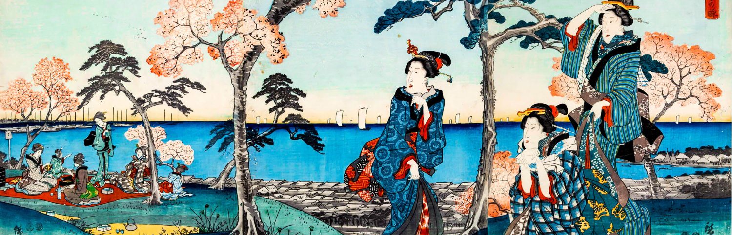
If you eliminate the train station and modern buildings, this a typical Edo Period river setting.
The name 神田 Kanda is one of the oldest place names in Edo-Tōkyō and believe it or not, 神田川 Kanda-gawa the Kanda River is not that old at all. Well, most of the river isn’t. Well, part of it might be.
Well, it’s complicated.
In short, after doing this research, I’ve realized I have to make a separate article about the area called 神田 Kanda – and by that, I mean just etymology. So I will write about that in the future – and I promise not to put it off too long. But let’s just deal with the river for the time being, mkay?
Let’s Look at the Kanji
| 神 | deities |
| 田 | rice paddies |
| 川 | river |
This river is manmade. So the etymology seems to be clear. At the beginning of the Edo Period, in the 神保町 Jinbō-chō area there was a small waterway that cut through a hilly are called 神田山 Kandayama Mt. Kanda. It’s said that since this area in general was called 神田 Kanda[ii] the original waterway was then called 神田川 Kanda-gawa the Kanda River.
If you only wanted to know the etymology of the river, you can stop reading here. From this point on it’s going to turn into a crazy – possibly boring – river mess. If you’re a JapanThis! masochist, then by all means, read on. You may actually enjoy this.

Where to Start??
Up until now, every river we have looked at was at some point a naturally occurring river. The Kanda River is quite different from those rivers. There was a time within recorded history that the Kanda River never existed. Though, a portion of it was once a natural tributary of a long vanished inlet of Edo Bay, it is, in fact, a man-made river. All though it may not be on the lips of every Tōkyōite, today the river is a well-recognized part of the well-manicured urban landscape of the modern city.
I actually first mentioned the Kanda River back in June, 2011 in an article about Yodobashi[iii], a small bridge that crosses the Kanda River at the border of 中野区 Nakano-ku Nakano Ward and 新宿区 Shinjuku-ku Shinjuku Ward. So this is something of a little homecoming for me. I started this blog when I still lived in Nakano (lived there for about 6 years).

What is the Kanda River Today?
The modern river’s official designation is the channel of water that flows from 井之頭池 Inokashira Ike Inokashira Pond to 飯田橋 Iidabashi (literally, Iida Bridge) where it empties into the 外堀 sotobori outer moat of Edo Castle. But it’s at this junction where the river flows into a disparate network of waterways. So you could say, unofficially, that the Kanda River flows into the 日本橋川 Nihonbashi-gawa Nihonbashi River and the 隅田川 Sumida-gawa Sumida River at 両国橋 Ryōgokubashi Ryōgoku Bridge, essentially taking the water to the Tōkyō Bay.

Now Let’s Talk History
As mentioned in my article on the etymology of Edo, the original 江戸城 Edo-jō Edo Castle or 千代田城 Chiyoda-jō Chiyoda Castle was not built by 太田道灌 Ōta Dōkan as is often cited[iv]. In reality, a minor branch of 平家 Hei-ke the Taira clan[v] moved to the area at the end of the 11th century and built a fortified residence[vi] on a hill overlooking the sea. As was common practice for new branch families with new fiefs, they took the name of the village 江戸郷 Edo-gō as their own and they became the 平江戸氏 Taira Edo-shi Edo branch of the Taira clan[vii]. In the 12th century, the area prospered due to its proximity to the capital of the Minamoto shōguns in Kamakura. However, it seems the Edo clan didn’t do much to develop the area’s rivers[viii].
In those days, the now long gone 日比谷入江 Hibiya Irie Hibiya Inlet was a saltwater inlet used for 海苔 nori seaweed farming[ix]. There was a certain freshwater river known as 平川 Hirakawa “the wide river” which emptied into the inlet. This fresh water river originally made up part of the natural boundary between 武蔵国豊島郡 Musashi no Kuni Toshima-gun Toshima District, Musashi Province and 武蔵国江原郡 Musashi no Kuni Ebara-gun Ebara Province, Musashi Province. This fresh water tributary seems to be where the story of the Kanda River begins.

Fast Forward a Few Centuries
By the 15th century, Japan was balls deep in the bloody, sweaty mess that was the Sengoku Period[x] and Ōta Dōkan found himself re-fortifying the Edo family’s fort in Chiyoda using water from the coastline and other small rivers with the latest moat-building technology of his day. The new and improved “Edo Fort” he built for the 上杉氏 Uesugi-shi Uesugi clan brought new channels and waterways into the village. This manipulation of water provided tactical advantages to the new fort in that food and goods could come in and there were more escape routes. There were now logical, defensible waterways. Lucky side effect, certain areas of the village were less exposed than before and local merchants and fishermen had new distribution routes and… BOOM! Ladies and gentleman, we have a budding 城下町 jōka machi castle town[xi].
Although all of Dōkan’s efforts were pioneering and crucial in the taming of the rivers and sea and urban planning of Edo-Tōkyō, one of the most important changes to Edo’s waterways was diverting the 平川 Hirakawa the ancient “wide river” eastward into what is today called the 日本橋川 Nihonbashi-gawa Nihonbashi River. This is critical to our story today. And the place where this new confluence occurred is actually marked by a bridge called the 神田橋 Kandabashi Kanda Bridge. The Hirakawa River doesn’t exist anymore, but a quick look at a map of Edo Castle will show you a 平川門 Hirakawa Mon Hirakawa Gate and 平川濠 Hirakawa-bori Harakawa Moat[xii]; the former, the gate that stood guard on the moat[xiii]; the latter, a vestige of the old river itself. Today, 平川見附 Hirakawa Mitsuke the bridge and fortified gate installation on the moat is a popular sightseeing spot.

They are on the same moat. That is the former Hirakawa.
I used JCastle.info to generate this map. Click on the picture to find THE premiere website on Japanese Castles in English.
So, as I’ve said before – and will say again – Tokugawa Ieyasu moved into an Edo that was well fortified, strategically sound, and extremely defensible by sea and by land. Oh, and did I mention, there was a burgeoning village life, supported by fishermen, farmers, and artisans[xiv]. Between Ōta Dōkan’s time and the time Ieyasu entered Edo, a technological revolution had occurred in Japan. From Nobunaga’s rise to power on, Japanese castles began to take on the look of what we think of today when someone says “Japanese Castle.[xv]” The castles of the Tokugawa Period are based on these new advances in castle building technology and reflected the amount of luxury the ruling class could not just afford, but were expected to maintain to project their image of superiority.

OK, OK! Castles.
Can We Please Get Back to the River?
Yes, of course. Sorry for getting distracted.
(But we’re probably coming back to castles)
The Tokugawa Shōgunate kept meticulous records of the changes they made to the area. The great waterworks projects were no exception. But I’m not going to get into every change they made. It’s so boring it’s unreal. So let’s just look at some of the major changes and what I think are the takeaways of what created the Kanda River.
Since I got distracted, let’s go back to the beginning.The beginning of the story is 1456-1457, when Ōta Dōkan began manipulating waterways to build moats for his pre-cursor to Edo Castle – though work on the moats most likely preceded construction of the fortress, so we might say 1455-1457. In 1486, Dōkan was assassinated and in 1524 the 江戸合戦 Edo Gassen Battle of Edo saw the rise of influence of the 後北条氏 Go-Hōjō-shi and the decline of the Ōta and Uesugi. This meant that the fortifications in 千代田 Chiyoda[xvi] (the area where the Sengoku forts where built and the fields around them) were abandoned and lay fallow for almost 70 years[xvii].
In 1590, Tokugawa Ieyasu transferred his clan and top retainers to Edo and began modernizing the old Sengoku Period fortifications of the Edo and Ōta. He cautiously applied some of the latest castle building technology following the examples of Oda Nobunaga and Toyotomi Hideyoshi. It’s said that the 大手御門 Ōte Go-mon Main Gate was one of the first construction project undertaken and this required crossing an existing moat – one affiliated with the later Kanda Aqueduct/Hirakawa.

1603 is the watershed moment. Ieyasu is named 征夷大将軍 seii tai-shōgun shōgun and is the effective military ruler of Japan. From this point, the real history of the Kanda River begins. In 1604, Nihonbashi is built and the 5 Great Highways of Edo are defined. Strict entry & exit points by land and by river are laid out in order to preserve the new Tokugawa hegemony. Edo’s waterways are no longer “just Edo waterways;” they are tactical routes, trade routes, and a means of regulating nature for the protection of the commoners who lived along the rivers and were, essentially, part of the city’s infrastructure. In short, the rivers of Edo became a stabilizing mechanism for the shōgun’s capital.

From 1616 to 1620, during the reign of 2nd shōgun Tokugawa Hidetada, something really resembling a “Kanda River” in a modern sense came in to existence. This is when the 神田山 Kandayama “Kanda Mountain”[xviii] was cut through and the Kanda River and Nihonbashi River became 2 discrete waterways. Kanda and Ryōgoku began to take on unique personalities at this time.

Check out how bad ass the castle was. Truly something to behold.
In 1657, disaster struck on a colossal scale. The 明暦大家 Meireki Fire[xix] ripped through the city destroying well over half of the metropolis[xx]. Although city planning was essential from the beginning, the shōgunate hadn’t anticipated the rapid growth that accompanied their sankin-kōtai policy and just the economic stability brought on by… um, stability in general.

In part of the rebuilding efforts after the Meireki Fire, from 1659-1661 various waterways in Edo were widened and more open space along the rivers was added. Edo grew so rapidly after the arrival of the Tokugawa, that the city had become a firetrap[xxi].

By some accounts, 60%-70% may have be burnt to the ground. Given the relative clean slate available to the shōgunate after this particular conflagration, certain rivers were designated as firebreaks and widened to keep fires localized[xxii]. It’s at this time that the Kanda River was dramatically widened – most notably, at the confluence of the Kanda River and Ryōgoku River, the 両国橋 Ryōgokubashi Ryōgoku Bridge was built. Even today, the expanse of the river here is something to see, but in the Edo Period, with no buildings over 2 stories, it was clearly a sight to behold. Soon the area became famous for a dazzling annual fireworks display in the summer[xxiii]. Some of the most iconic 浮世絵 ukiyo-e “scenes of the transient world” come from this area. The 江戸東京博物館 Edo-Tōkyō Hakubutsukan Edo-Tōkyō Museum is located in this area… for obvious reasons.

Ganbare, Kanda-chan!
As I mentioned before, the official headwaters are 井之頭池 Inokashira Ike Inokashira Lake, but the river has no officially designated end point but it’s fairly certain that it ultimately empties into Tōkyō Bay. Traditionally it ends at 飯田橋 Iidabashi. The reason there’s no official ending point is because the Kanda River empties into a few rivers and drainage channels along the way before it ultimately fizzles out into the 隅田川 Sumida-gawa Sumida River at 両国橋 Ryōgokubashi Ryōgoku Bridge. If you’ve been following this series, you’ll probably be aware that the names and courses of these rivers have been changing over time and that some stretches of one river may have had multiple names depending on the area. So yeah… welcome back to the Confus-o-dome.

Gross.
The Kanda River’s Legacy
The man-made Edo Era waterway that flowed from Inokashira Pond was called the 神田上水 Kanda Jōsui. Longtime readers should know what a 上水 jōsui is. But just a refresher, a jōsui is a conduit of “imported” water. This water flowed from 三鷹 Mitaka[xxiv] to Edo Castle; it also supplied drinking water to the daimyō mansions that lined its course.

The Kanda Jōsui is considered the first real aqueduct system in Japan. Before I mentioned the technological revolution in castle construction, right? Well, the Sengoku Period began stabilizing and yes, castle building was a status thing. But the distribution of water and water management showed one of the greatest advances in urban planning and administration that Japan had seen in centuries. This is why shōgunate’s founder, Tokugawa Ieyasu, was such a bad ass. The dude could lead an army here or there, but he had ideas about civil administration and surrounded himself with people who could advise him on these things. Oda Nobunaga and Toyotomi Hideyoshi were essentially one-trick-ponies who couldn’t really get out of the 戦国病気 Sengoku Byōki “Sengoku Rut.”[xxv] Ieyasu, also a product of that generation, realized that infrastructure reinforced military supremacy and brought economic stability[xxvi].

Admittedly, it’s not that exciting or cool, but the availability of clean drinking water and disposal of dirty water should never be underestimated in the study of any ancient or pre-modern city[xxvii].
The capital of the Tokugawa shōguns quickly became the biggest city in Japan and eventually the most populous city in the world. Clean water and sewerage undeniably played a part in this. But soon the Kanda Jōsui wasn’t enough. That said, it was the main source of drinking water for Edo Castle during the Edo Period.
Even if it was inadequate to supply the entire sprawling capital, Kanda Jōsui was such a successful project that it begot 6 more major waterworks in Edo, all of which benefited daimyō, samurai, and the commoner population. Of course, this technology spread throughout the realm, but for short while Edo boasted one of the most unique water infrastructures in Japan.

A Final Note
If you’re up for an interesting bike ride, a 2010 blog post at Metropolis suggests starting at the mouth of the river and riding upstream to Inokashira Pond. When the temperature starts to come down, I may give this a go myself. There are loads of spots, many covered in JapanThis!, along the course of the river, so it should be fascinating.
Further Reading:
..
[i] I know that’s not the kind of helpful explanation that will bring closure to any of the etymology fans out there.
[ii] As I said, I’m gonna revisit this topic again.
[iii] Any relation to ヨドバシカメラ Yodobashi Camera? Why, yes there is. Thank you for asking.
[iv] And calling Dōkan’s fortifications a “castle” is also a debatable point. I’ve come to prefer the term “well-moated fort.” I came up with that term all on my own… right now. Thank you very much.
[v] If you don’t know who the Taira clan is… wow. OK, here you go.
[vi] Also, as mentioned in my article on What does Edo mean?, the coastal area is littered with 古墳 kofun burial mounds and it’s clear from the archaeology that the area has been inhabited since Paleolithic times. It’s highly doubtful the Edo clan was the first strongmen to seize upon this highly defensible, coastal plateau – they are the noblest recorded family, though.
[vii] Even though other temples and villages in the area are mentioned as far back as the Heian Period, it’s seems like the name Edo itself doesn’t actually appear in any records until the Kamakura Period.
[viii] In fact the original Edo “Castle” was probably just a 出城 dejiro satellite fort, since the Edo clan seemed to have their main residence in 喜多見 Kitami in present 世田谷区 Setagaya-ku Setagaya Ward.
[ix] I have an article about Hibiya.
[x] And while this may sound like a gratuitous reference to sex on the rag, this is actually a legitimate, historical term. Ask any historian of Pre-Modern Japan. They’ll tell you. Just ask. Seriously.
[xi] Let’s not get ahead of ourselves. I said “budding.” When we say “castle” and “castle town” today we are usually referring to a construct of the far more stable Azuchi-Momoyama Period (ie; essentially the end of the Sengoku Period).
[xii] On Edo Era maps these may be listed with honorifics as 平川御門 Hirakawa Go-Mon Hirakawa Gate and 平川御堀 Hirakawa O-Hori Hirakawa Moat, respectively.
[xiii] Interestingly, some people think the radius and extent of Ōta Dōkan’s moats was the result of him not having a fucking clue what he was doing. His initial “improvements” lead to more flooding and so he continually modified his plans, diverting rivers away from the castle and the villages by extending them further and further out. Thus part of the sprawling nature of Edo Castle may have been due to stop-gap measures employed by Dōkan.
[xiv] Yes, I did.
[xv] This is as different as when we use the Latin words castrum to describe a Roman military camp/walled town and a castellum a walled fortification of Late Antiquity. The transformation is truly dramatic.
[xvi] You can see my article on Chiyoda here.
[xvii] The castle itself was pretty minor and was most likely not affected by the Late Hōjō efforts to refortify the Edo area from 1583 on.
[xviii] Kandayama was located in present day 駿河台 Surugadai.
[xix] “What’s the Meireki Fire?” you ask. There’s an article for that.
[xx] By some accounts, 70% of the city may have been destroyed.
[xxi] This didn’t change until the reconstruction of the city after WWII (or, some may argue that it didn’t change until the 1960’s and that the city just got lucky with no major conflagrations in the interim).
[xxii] In theory…
[xxiii] People today love fireworks. Just imagine what people with no video, no cameras, and no Perfume must have thought of these theatrical celebrations of summer.
[xxiv] Essentially, present-day Kichijōji.
[xxv] Again, my word. I just made it up now. And yes, I’m just baiting Sengoku lovers. Actually, I like Nobunaga, too.
[xxvi] And far more importantly, put his family in a seemingly endless position as hereditary top of the food chain. Hmmmmmmmmmm…
[xxvii] And you probably never think about where your water comes from or how it gets to your house and where it all goes afterwards, but it works, right? That’s why you can live there.

Awesome stuff! I love that old colorized shot of Hirakawa Gate.
I thought you’d like that. Probably one of my favorite pix of the entire blog!